ASHEVILLE, N.C. (828newsNOW) — Rain is moving out of Western North Carolina on Thursday as a cold air wedge settles in behind a departing storm system, bringing cooler-than-normal temperatures to the region.
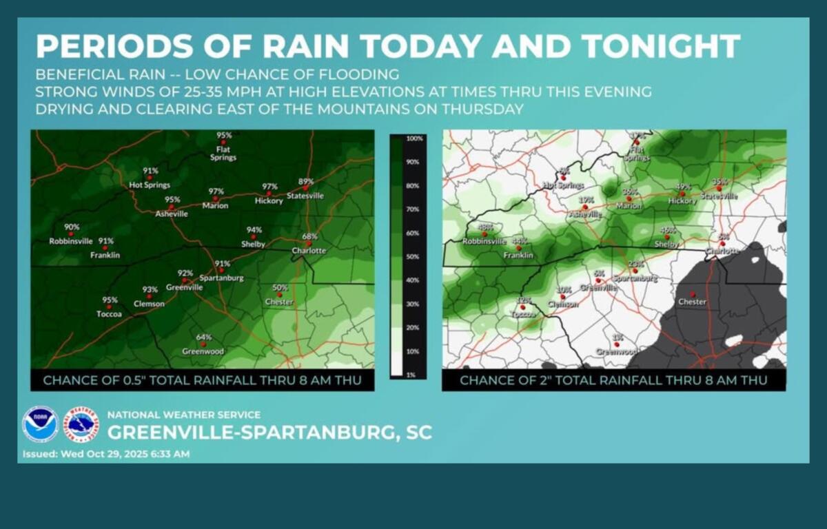
The National Weather Service says to expect occasional drizzle and sprinkles early Wednesday, with heavier rainfall expected by late afternoon and continuing into the night. Most areas could see at least half an inch of additional rain, while the southern and eastern mountains and foothills may receive 1 to 2 inches. Isolated flash flooding remains possible along the east-facing slopes of the Blue Ridge Escarpment, though the risk at any one location is below 5 percent.
Temperatures Wednesday are expected to remain 10 to 20 degrees below normal, with the coldest readings in the heart of the wedge, the NWS said in its Hazardous Weather Outlook.
High-elevation ridges above 3,500 feet may see gusty winds of 35 to 45 mph from Thursday afternoon through early Friday morning.
Forecasters said showers will taper off Thursday, giving way to partly sunny skies. Friday is expected to be sunny but chilly, especially in the morning and evening, with highs near 55 and lows around 34. Patchy frost may appear Friday night and Saturday morning. Weekend highs are expected in the upper 50s to around 60.
At Mount Mitchell, North Carolina’s highest peak, temperatures dropped to 31 degrees Wednesday morning, producing rime ice on trees.
Carolina Weather Association noted that while it won’t be unusually cold, temperatures below the seasonal average will make late October feel brisk, signaling the approach of November and the holiday season.
Forecast highlights:
- Today: Showers after 10 a.m., patchy fog in the afternoon. High near 50. East winds 13-16 mph, gusts up to 25 mph. Chance of rain 80%.
- Tonight: Showers and patchy fog. Low around 42. East winds 5-10 mph, gusts up to 18 mph. Chance of rain 90%.
- Thursday: Partly sunny, high near 54. West-northwest winds 6-16 mph, gusts up to 24 mph. 40% chance of showers.
- Friday: Sunny, high near 55. Northwest winds 10-15 mph, gusts up to 24 mph. Low around 34 with patchy frost.
- Saturday: Mostly sunny, high near 59. Low around 35. Patchy frost possible.
- Sunday: Mostly sunny, high near 60.