ASHEVILLE, N.C. (828newsNOW) — The National Weather Service in Greenville-Spartanburg has issued a Freeze Warning for much of Western North Carolina, warning residents to prepare for the first hard freeze of the season late Friday night into Saturday morning.
Temperatures are expected to fall into the upper 20s and low 30s, with sub-freezing lows near 28 degrees possible in some valleys. The warning is in effect from 2 a.m. to 9 a.m. Saturday for Buncombe, Henderson, Transylvania, Jackson, Macon and McDowell counties, as well as Rabun County, Georgia.
According to the weather service, frost and freeze conditions could kill crops and other sensitive vegetation and may damage unprotected outdoor plumbing. Residents are encouraged to cover tender plants, bring potted plants indoors, drain sprinkler systems and wrap or insulate exposed pipes before temperatures drop overnight.
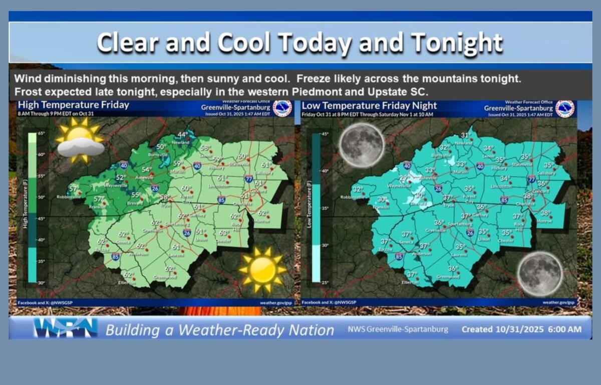
Cold, dry air will settle into the region Friday night as clear skies and light winds allow for strong radiational cooling, forecasters said in a morning update. This will bring widespread frost and freezing conditions across the mountains and foothills.
A Freeze Watch also extends into portions of northeast Georgia, the western Upstate of South Carolina and the North Carolina Piedmont, where temperatures could drop as low as 33 degrees.
The chill follows a windy Halloween morning that prompted a Wind Advisory for Avery, Mitchell and Yancey counties, with gusts up to 45 mph. Winds are expected to calm by afternoon, leading to a clear, cool day with highs near 55 degrees in Asheville and surrounding areas.
Local outlook
- Asheville: Low around 32 Saturday morning with patchy frost likely; daytime high near 55.
- Hendersonville: Temperatures could dip to 30 degrees with frost on lawns and gardens; sunny skies expected during the day.
- Waynesville: Lows near 28-30 degrees, with frost expected in low-lying areas; highs in the mid-50s.
- Transylvania and Jackson counties: Expect widespread frost, especially in valleys, with temperatures near freezing.
The weekend forecast calls for continued dry, sunny days and cold nights through Saturday, with a chance of light rain late Saturday night into Sunday as a fast-moving low-pressure system passes through. Daytime temperatures are expected to reach the upper 50s Saturday and mid-50s Sunday before a gradual warming trend returns next week.