ASHEVILLE, N.C. (828newsNOW) — Western North Carolina is heading into a stretch of early-summer heat this week, with temperatures running well above normal before a cold front brings a modest increase in rain chances later in the week.
The National Weather Service in Greenville-Spartanburg says sunny, dry conditions will dominate through midweek, with highs running about 7 to 12 degrees above seasonal averages. That puts many mountain and foothill communities near or just above 90 degrees through Tuesday and Wednesday.
Despite the heat, forecasters say it won’t feel especially muggy. Dew points are expected to stay low enough to keep heat index values close to actual air temperatures, meaning the heat should feel more like a dry “summer preview” than a humid stretch of midsummer air.
“Thus, we shall bake as if in an oven,” forecasters noted in their discussion, describing the lack of cloud cover or meaningful storm development through early week.
Rain chances remain slim until midweek, when a cold front approaches from the Ohio Valley. That system could bring scattered showers and thunderstorms beginning Wednesday afternoon, though forecasters caution the best moisture may stay to the west of the mountains.
By Thursday and Friday, unsettled weather becomes more likely as the front moves closer. Showers and thunderstorms are expected to become more widespread, with Thursday carrying the highest rain chances of the week.
Temperatures will respond to the changing pattern, dipping into the low-to-mid 80s Thursday and sliding further to the mid-70s on Friday as clouds and rain increase.
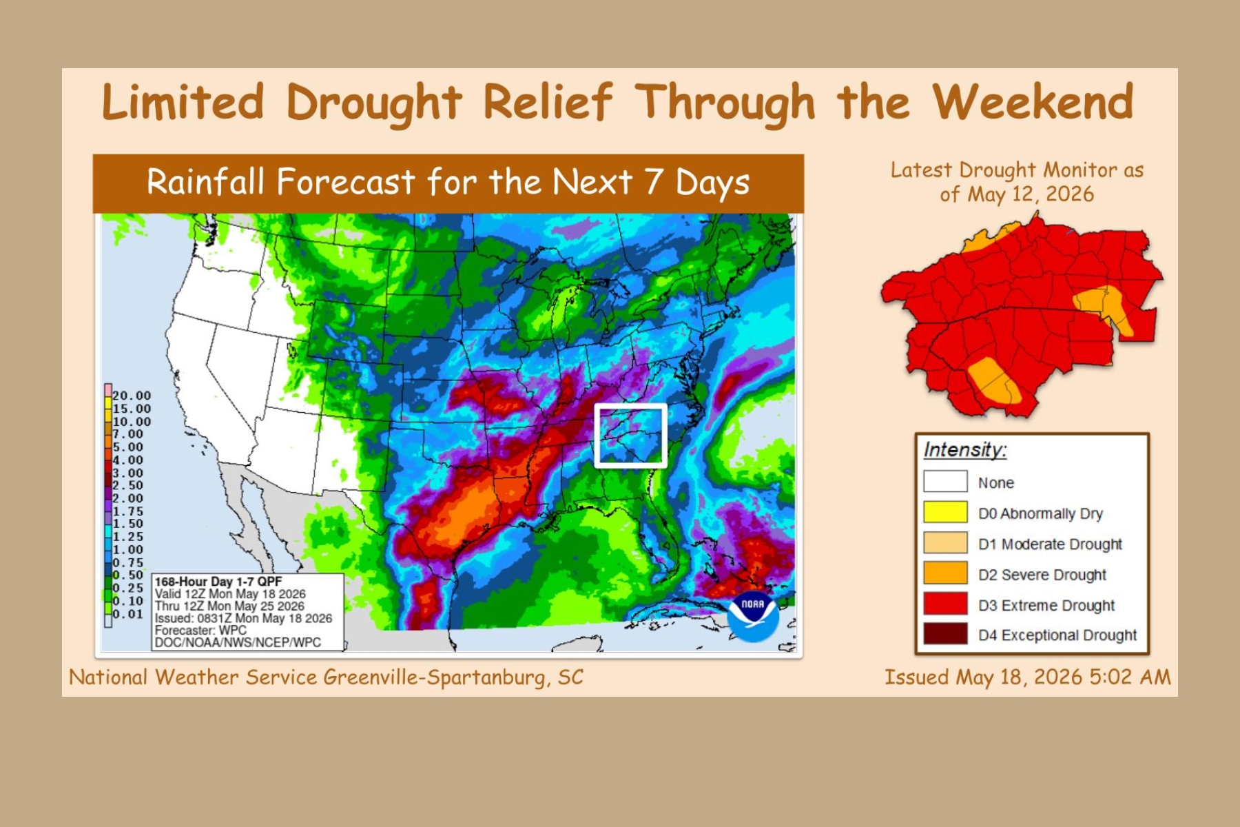
Even with the incoming system, forecasters say drought relief will be limited. The region remains in extreme drought conditions, according to the U.S. Drought Monitor, and rainfall totals are not expected to be high enough to significantly improve long-term deficits.
Since Jan. 1, Asheville is running nearly 8 inches below normal in precipitation.
Looking ahead to the weekend, conditions are expected to remain somewhat unsettled, with periodic rain chances continuing. However, forecasters say the risk for severe storms appears low, and there are no indications of a widespread soaking rain event.
For now, the message is straightforward: a hot, dry start to the week, followed by increasing clouds and scattered rain chances — but not enough, at least yet, to erase Western North Carolina’s growing rainfall deficit.