ASHEVILLE, N.C. (828newsNOW) — Summer is showing up early in Western North Carolina, and it plans to stick around.
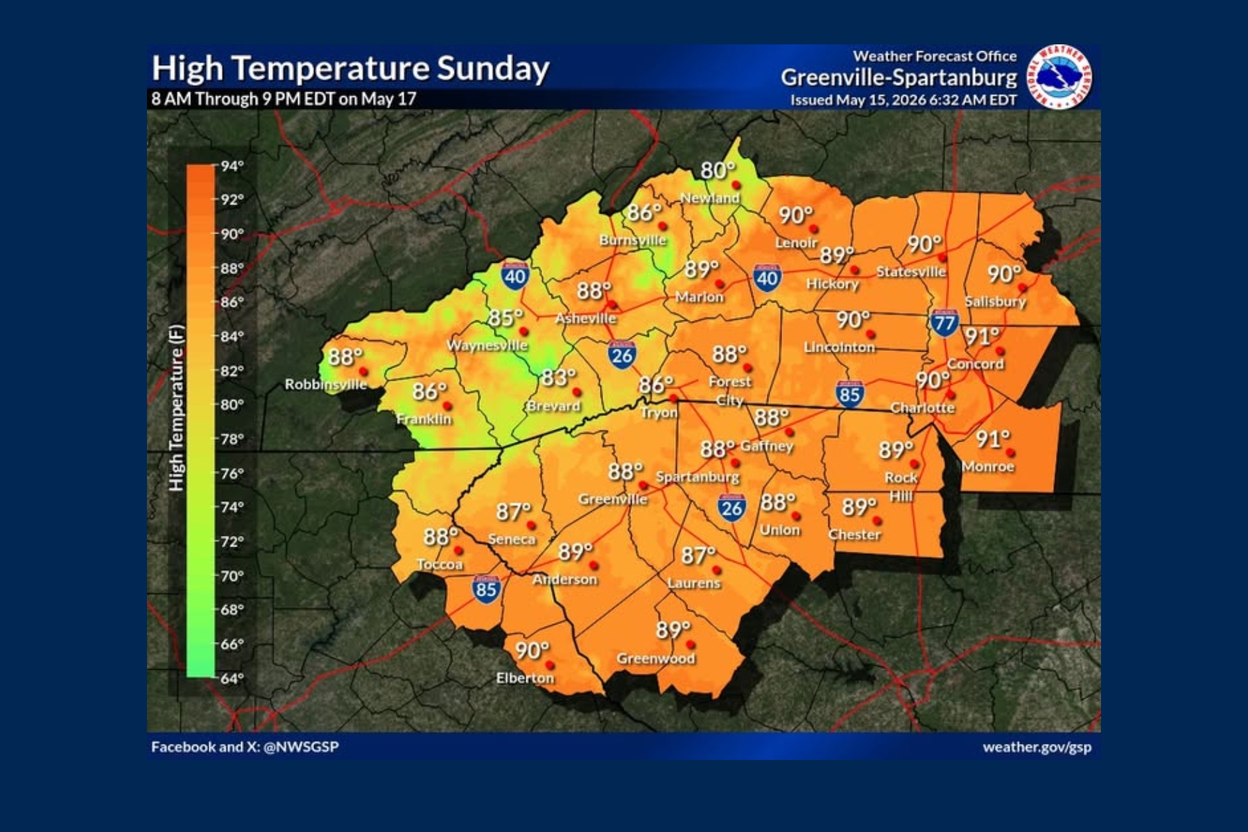
The National Weather Service in Greenville-Spartanburg says a warming trend this weekend will push afternoon highs into the upper 80s and lower 90s across lower elevations by Sunday, with humidity steadily building through early next week.
Forecasters say the region is settling into a more classic summer pattern, driven by strengthening high pressure over the western Atlantic. After a relatively cool night Friday under clear skies, temperatures are expected to climb quickly through the weekend — about 5 degrees above normal Saturday and closer to 10 degrees above average by Sunday and Monday.
With the added heat and moisture, a few isolated afternoon showers or thunderstorms could pop up Sunday and Monday, mainly over the mountains. While most of the activity is expected to be scattered and brief, forecasters say a few stronger “pulse-type” storms can’t be ruled out.
By Tuesday and Wednesday, the heat continues, with highs generally in the upper 80s and low 90s and only a slight chance of mainly afternoon, or diurnal, thunderstorms.
A better chance for widespread rain arrives Thursday into Friday as a cold front moves across the region. That front is expected to bring showers and thunderstorms, followed by a shift to cooler and more seasonable temperatures by Friday.
Even with the late-week rain chances, forecasters say rainfall amounts look light overall, meaning it likely won’t do much to ease ongoing dry conditions.
According to the U.S. Drought Monitor, Buncombe County and much of Western North Carolina remain in extreme drought. The National Weather Service also reports Asheville is more than 7.5 inches below normal precipitation since the start of the year.
Asheville forecast
- Saturday: Mostly sunny, high near 86
- Sunday: Mostly sunny, high near 89
- Monday: Sunny, high near 88
- Tuesday: Sunny, high near 89
- Wednesday: Showers and thunderstorms likely, high near 86 (60% chance)
- Thursday: Showers and thunderstorms likely, high near 85 (70% chance)
Nighttime lows will generally hold in the upper 50s to low 60s through the period.