ASHEVILLE, N.C. (828newsNOW) — Hopes for a snow-filled winter storm in the mountains of Western North Carolina are fading as forecasters warn the region is instead facing a potentially dangerous ice storm that could bring widespread travel disruptions, power outages and prolonged cold.
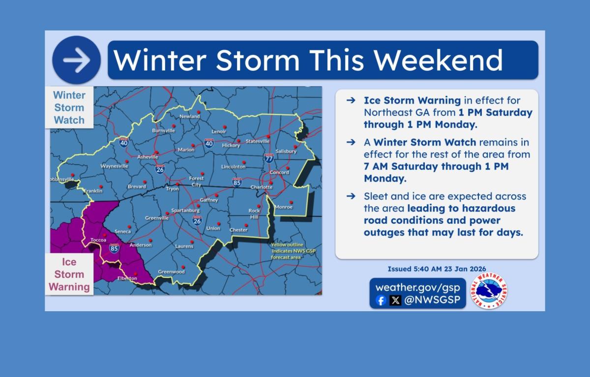
The National Weather Service in Greenville-Spartanburg issued an Ice Storm Warning for parts of northeast Georgia from Saturday afternoon through Monday afternoon and said ice totals for the weekend system have increased. Forecasters say similar conditions are increasingly likely across parts of the Carolinas, including the Asheville area.
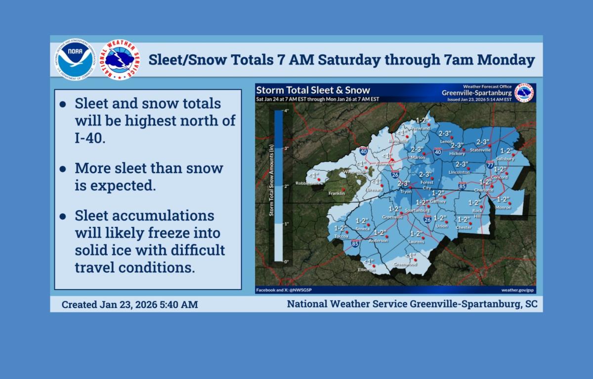
The primary threat is ice, not snow. While a brief period of snow or sleet is possible at the onset late Saturday, the storm is expected to transition quickly to sleet and then heavy freezing rain, which could become the dominant precipitation type by Sunday morning.
In the highest-risk areas, ice accumulations could exceed one inch where cold air and moisture overlap most strongly. Forecasters said cold air appears stronger and longer-lasting than some models initially suggested, allowing freezing rain to extend farther south, potentially as far as metro Atlanta and Columbia, South Carolina.
Travel conditions could deteriorate rapidly Sunday, with roads becoming nearly impassable. Power outages are also possible as ice accumulation combines with wind gusts of 30 to 40 mph. Little immediate melting is expected, raising concerns about repeated thaw-and-refreeze cycles into next week.
A Winter Storm Watch remains in effect from Saturday morning through Monday afternoon for much of Western North Carolina, Piedmont North Carolina and Upstate South Carolina.
Following the end of wintry precipitation early Monday, temperatures are expected to remain very cold through much of next week. The National Weather Service warned that dangerously low wind chills could prompt cold weather advisories, particularly Monday night and again midweek. The cold could be especially hazardous if power outages persist.
Forecasters said roads are likely to remain icy and treacherous into early next week and urged residents to closely monitor forecasts, limit travel during the storm and prepare for extended power outages.
Weather details for Asheville indicate mostly cloudy skies Friday with a high near 48 and lows dropping into the mid-20s overnight. Saturday brings a chance of snow before transitioning to sleet and freezing rain by evening, with temperatures hovering in the mid-30s. Freezing rain is expected Saturday night and Sunday before tapering to rain late Sunday, followed by sharply colder temperatures Sunday night.