ASHEVILLE, N.C. (828newsNOW) — As Western North Carolina residents stocked up on groceries, checked their heaters and eyed the sky Friday morning, forecasters warned that another round of winter weather was about to turn the region into a snow-covered landscape and bring some of the coldest air of the season.
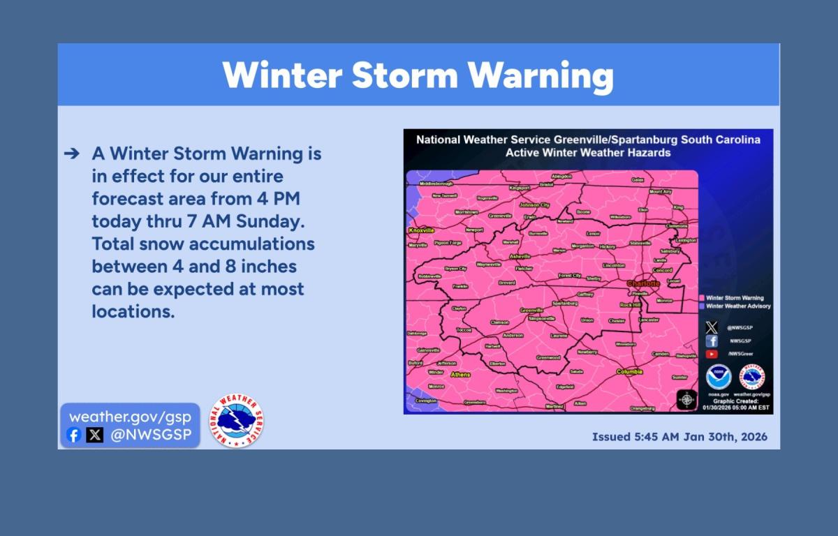
A winter storm warning is in effect for the mountains and foothills of Western North Carolina from 4 p.m. Friday through 7 a.m. Sunday, with forecasters calling for significant snowfall, dangerous cold and hazardous travel.
The National Weather Service in Greenville-Spartanburg said the storm is expected to bring mainly snow, with at least 3 inches likely across the forecast area and higher totals possible where heavier snow bands develop. Snowfall projections along and north of Interstate 40 remain less certain but have increased in recent forecasts.
Because of subfreezing temperatures leading into the storm, officials said snow and ice are more likely to stick to roadways, making travel dangerous. Blowing snow and reduced visibility are also possible as winds increase. While widespread blizzard conditions are not expected, forecasters said brief blizzard-like conditions cannot be ruled out.
An extreme cold watch is also in effect from Saturday afternoon through Sunday afternoon as a strong Arctic air mass moves in behind the storm.
Temperatures are expected to remain below freezing across much of the area into Monday. Highs Saturday will likely stay below freezing, with mountain communities seeing temperatures in the teens and lower 20s. Overnight lows could fall into the single digits in the mountains and the low teens elsewhere.
Wind chills could drop to between 10 and 25 degrees below zero in the mountains and between 5 and 10 below zero outside the mountains, creating what forecasters described as dangerous conditions for anyone without adequate heat or shelter. Prolonged cold also raises the risk of burst pipes and other infrastructure problems.
Meteorologist Hunter Ward of Ashevillewx said updated data points to widespread snowfall of 4 to 8 inches across Western North Carolina, with some peripheral areas seeing slightly lower totals. He said light snow could begin Friday afternoon, with steadier snowfall developing by evening and becoming widespread by midnight.
Wind gusts could exceed 30 mph as the system exits late Saturday or early Sunday, potentially producing whiteout conditions at times, Ward said.
National Weather Service officials urged residents to limit travel, prepare for possible power outages, protect pipes, secure alternative heat sources and keep enough food and water on hand for several days.
Forecasters said the bitter cold will linger into early next week before a gradual warming trend and drier weather return. Another chance of precipitation could arrive by midweek.